Introduction
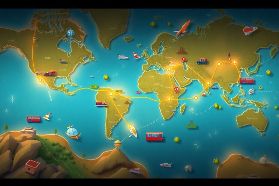
In today's digital age, visual storytelling has become an essential component of travel content creation. Among the various tools available to content creators, animated travel route maps have emerged as a powerful medium for engaging audiences and bringing journeys to life. These dynamic visualizations transform static itineraries into exciting, interactive experiences that captivate viewers and enhance the overall narrative of travel stories.
As a tech enthusiast and avid traveler, I've explored numerous applications and techniques for crafting these animated maps. This comprehensive guide will delve into the best apps and methods for creating animated travel route maps, providing in-depth instructions and valuable insights for both novice users and seasoned content creators.
The Power of Animated Travel Route Maps
Animated travel route maps offer a multitude of benefits that extend beyond mere aesthetic appeal. They serve as powerful tools for storytelling, information dissemination, and audience engagement. By visually representing a journey's progression, these maps allow viewers to mentally traverse landscapes and connect with the narrative on a deeper level.
From a neuroscientific perspective, animated visuals stimulate multiple areas of the brain simultaneously, enhancing information retention and emotional connection. According to a study published in the Journal of Computer Assisted Learning, dynamic visualizations can significantly improve spatial understanding and recall compared to static images. This makes animated travel maps particularly effective for conveying complex itineraries and geographical relationships.
Moreover, in the context of social media algorithms that favor engaging content, animated posts tend to perform better in terms of reach and interaction. A report by Socialbakers found that video content on Facebook generates 59% more engagement than other post types. By incorporating animated travel maps into your content strategy, you can potentially boost your visibility and foster stronger connections with your audience.
Top Apps for Creating Animated Travel Route Maps
1. Travelboast
Travelboast has established itself as a go-to application for creating animated travel route maps, boasting a user base of millions across both Android and iOS platforms. Its popularity stems from its intuitive interface and extensive feature set, making it accessible to users of all skill levels.
Key Features:
- Over 100 modes of transportation, ranging from realistic options to whimsical choices
- GPX track import functionality for accurate route mapping
- Customizable map styles and animation speeds
The app's strength lies in its balance between simplicity and functionality. While some users might find the vast array of transportation options overwhelming, it allows for creative expression and personalization of travel narratives. The GPX import feature is particularly valuable for outdoor enthusiasts and adventure travelers who want to accurately represent their exact routes.
How to Use Travelboast:
- Download the app from your device's app store
- Input your journey's starting point, destination, and intermediate stops
- Select your preferred mode(s) of transportation
- Customize map appearance and animation style
- Generate and export your animated map
Travelboast's interface is designed with user experience in mind, allowing for quick creation of visually appealing animations. However, more advanced users might find the customization options somewhat limited compared to desktop alternatives.
2. TravelAnimator
TravelAnimator offers a compelling balance between ease of use and customization options, making it a favorite among content creators who want more control over their animations without sacrificing user-friendliness.
Key Features:
- Multiple animation styles to suit different aesthetic preferences
- Ability to highlight points of interest along the route
- Direct sharing to various social media platforms
The app's strength lies in its social media integration, allowing for seamless sharing of content across platforms. This feature is particularly valuable in today's interconnected digital landscape, where cross-platform consistency is key to building a strong online presence.
How to Use TravelAnimator:
- Install the app from your device's app store
- Enter your travel route, including all planned stops
- Choose your preferred map style and vehicle representation
- Add highlights or points of interest along your route
- Preview the animation and make any necessary adjustments
- Export the animation or share directly to social media
While TravelAnimator offers a robust free version, some of its more advanced features are locked behind a paywall. This tiered approach allows users to test the app's capabilities before committing to a purchase, but it may be a drawback for those seeking full functionality without cost.
3. Pictramap
Pictramap stands out as a web-based solution for creating animated travel maps, eliminating the need for app downloads and offering cross-platform compatibility.
Key Features:
- Various map types and styles to choose from
- Intuitive drag-and-drop interface for route creation
- Option to incorporate photos at designated stops
The web-based nature of Pictramap makes it an excellent choice for users who prefer working on larger screens or those who frequently switch between devices. Its photo integration feature adds an extra layer of personalization to travel narratives, allowing creators to showcase specific moments from their journeys.
How to Use Pictramap:
- Navigate to the Pictramap website
- Select your preferred map type and style
- Plot your route by adding and arranging stops
- Choose a vehicle icon for your animation
- Upload and add photos to specific stops if desired
- Generate and download your animated map
While Pictramap offers a free version, users may find some limitations in terms of available features. Additionally, the requirement for an internet connection may be a drawback for those who need to work offline.
4. SmartSHOW 3D
For Windows users seeking professional-grade animation capabilities, SmartSHOW 3D offers a robust set of tools for creating highly customized travel route maps.
Key Features:
- Over 700 effects and animations for enhanced visual appeal
- Voice comment addition for narrated travel stories
- Multiple export options to suit various platforms and purposes
SmartSHOW 3D's extensive customization options set it apart from mobile alternatives, allowing for the creation of truly unique and professional-looking animations. The ability to add voice comments is particularly valuable for content creators looking to provide detailed narration alongside their visual presentations.
How to Use SmartSHOW 3D:
- Download and install the software on your Windows PC
- Start a new project and select the travel map template
- Input your route details and customize the map's appearance
- Add desired effects, voice comments, and background music
- Preview your animation and make any final adjustments
- Export your video in your chosen format
While SmartSHOW 3D offers unparalleled customization options, its PC-only availability and steeper learning curve may be deterrents for some users. However, for those willing to invest the time, the software provides the tools to create truly professional-grade travel route animations.
Advanced Techniques for Creating Engaging Animated Maps
Beyond the basic functionality offered by these apps, there are several advanced techniques that can elevate your animated travel route maps to the next level:
Implementing Keyframe Animation: For those using more advanced software like After Effects, keyframe animation allows for precise control over the timing and movement of map elements. This technique can create smoother transitions and more dynamic animations.
Incorporating Data Visualization: Integrating data such as distance traveled, time spent at each location, or even environmental factors (like weather or terrain) can add depth to your animations. Tools like Tableau or D3.js can be used in conjunction with map creation software to achieve this.
Using 3D Mapping: Some advanced tools like Google Earth Studio allow for the creation of 3D animated maps, providing a more immersive experience for viewers. This can be particularly effective for showcasing routes through mountainous regions or cities with distinctive skylines.
Augmented Reality Integration: As AR technology becomes more accessible, incorporating animated travel maps into real-world environments via AR apps can create unique and interactive experiences for users.
The Future of Animated Travel Route Maps
As technology continues to evolve, we can expect to see significant advancements in the field of animated travel route mapping. Machine learning algorithms may soon be able to automatically generate optimized routes based on user preferences and travel history. Virtual reality integration could allow users to "step into" their animated maps, experiencing a virtual preview of their planned journeys.
Furthermore, the increasing availability of real-time data feeds could lead to dynamic maps that update based on current conditions, such as traffic, weather, or even crowd levels at popular attractions. This would provide travelers with not just a representation of their route, but a living, breathing guide to their journey.
Conclusion
Animated travel route maps have revolutionized the way we share and consume travel experiences. From simple mobile apps to advanced desktop software, the tools available today cater to a wide range of needs and skill levels. By leveraging these technologies, content creators can craft engaging, informative, and visually stunning representations of their journeys.
As we look to the future, the potential for innovation in this field seems boundless. The integration of augmented reality, artificial intelligence, and real-time data promises to make animated travel maps even more immersive and informative. For tech enthusiasts and travel lovers alike, the evolving landscape of animated route mapping offers an exciting frontier to explore.
Whether you're a casual traveler sharing your adventures with friends and family, or a professional content creator looking to engage a wider audience, mastering the art of animated travel route maps can significantly enhance your storytelling capabilities. By combining technical skill with creative vision, you can transform simple itineraries into captivating visual narratives that inspire wanderlust and bring the joy of travel to viewers around the world.