Introduction
In our increasingly connected world, the need to find convenient meeting points or plan efficient routes has become more important than ever. Whether you're arranging a meetup with friends, planning a business rendezvous, or organizing a road trip pit stop, knowing how to find the halfway point between two locations can be incredibly useful. While Google Maps is a powerful navigation tool used by millions daily, it surprisingly lacks a built-in feature to directly calculate midpoints. However, this doesn't mean it's impossible. In this comprehensive guide, we'll explore several methods to help you find that elusive halfway point using Google Maps and some clever workarounds.
The Importance of Finding Halfway Points
Before diving into the technical aspects, it's worth considering why finding a halfway point matters so much in various scenarios. The concept of a "fair" meeting point has psychological as well as practical implications. When friends or colleagues are coming from different locations, meeting in the middle ensures that no one party feels like they're bearing an unfair burden of travel. This can be particularly important in business settings where maintaining equitable relationships is crucial.
From a logistical standpoint, halfway points are invaluable for efficient trip planning. Long-distance drivers often need to identify optimal rest stops or overnight stays to break up their journey safely and comfortably. Businesses use midpoint calculations for strategic decisions like where to locate offices or distribution centers to minimize overall travel or shipping distances. Even in personal life, families moving to a new area might use this technique to find a home that balances commute times for different family members.
The applications are diverse, ranging from simple social meetups to complex logistical planning. Now, let's explore how to harness the power of Google Maps to find these crucial midway points.
Method 1: Using the Measure Distance Feature
One of the simplest ways to approximate a halfway point is by using Google Maps' built-in "Measure Distance" tool. This method is particularly effective when working on a desktop browser, offering a visual and intuitive approach to finding midpoints.
To use this feature:
- Open Google Maps in your web browser.
- Locate your starting point on the map.
- Right-click on the starting point and select "Measure distance" from the dropdown menu.
- Click on your destination point. Google Maps will draw a straight line between the two points and display the total distance.
- Look for distance markers along the line – the halfway point will be near the middle marker.
This method is straightforward and doesn't require any additional tools or calculations. It provides a quick visual representation of the route and an approximate midpoint. However, it's important to note that this approach has limitations. It calculates distance as the crow flies, not taking into account actual road routes or travel times. For short distances in urban areas, this can lead to significant inaccuracies. Additionally, the feature is less user-friendly on mobile devices, where right-clicking isn't an option.
Despite these drawbacks, the Measure Distance tool remains a useful first step in many scenarios, especially for getting a general idea of where a midpoint might lie.
Method 2: Using Geographic Coordinates
For those seeking more precision, especially over longer distances, using geographic coordinates can provide a more accurate midpoint. This method works well on both desktop and mobile devices and can be particularly useful for finding midpoints between distant cities or even countries.
Here's how to use this method:
- Find the coordinates of your starting point:
- On desktop: Right-click the location and select the coordinates.
- On mobile: Long-press the location and tap the coordinates that appear.
- Repeat this process for your destination point.
- Calculate the midpoint:
- Add the latitudes of both points and divide by 2
- Add the longitudes of both points and divide by 2
- Enter the new coordinates into Google Maps search bar to find your midpoint.
Let's look at an example to illustrate this process:
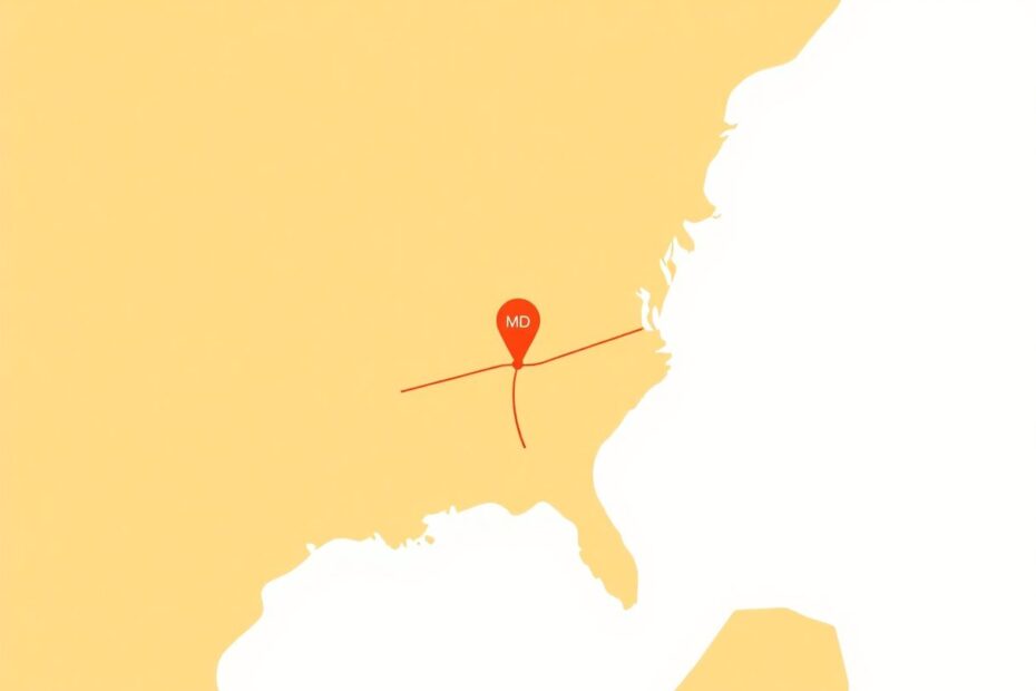
Starting point: New York City (40.7128° N, 74.0060° W)
Endpoint: Boston (42.3601° N, 71.0589° W)
Midpoint calculation:
- Latitude: (40.7128 + 42.3601) / 2 = 41.53645° N
- Longitude: (-74.0060 + -71.0589) / 2 = -72.53245° W
Midpoint: 41.53645° N, 72.53245° W
When you enter these coordinates into Google Maps, you'll find that the midpoint falls somewhere in Connecticut, which makes intuitive sense given the locations of New York and Boston.
This method is highly accurate for calculating the geographic midpoint and works well for any distance. It's especially useful for long-distance planning or when you need a precise location for data analysis or other technical applications. However, like the Measure Distance tool, it doesn't account for actual road routes or travel times, which can be a significant factor in real-world travel planning.
Method 3: Leveraging Third-Party Tools
While Google Maps itself doesn't offer a built-in halfway point finder, several third-party tools have been developed to fill this gap. Many of these integrate seamlessly with Google Maps, providing a more comprehensive solution for finding midpoints and nearby points of interest.
Some popular third-party options include:
MeetWays: This tool not only finds midpoints but also suggests convenient meeting places like restaurants or cafes near the calculated midpoint.
Whatshalfway.com: Offering a simple interface, this website allows users to find midpoints between two addresses quickly and easily.
Geomidpoint.com: A more advanced tool that allows for multiple locations and provides detailed geographic information along with the midpoint calculation.
To use these tools, typically you would:
- Visit the website of your chosen tool.
- Enter your starting point and destination.
- Click a button like "Find Midpoint" or "Calculate."
- Review the suggested midpoint and nearby points of interest.
- Often, these tools allow you to open the results directly in Google Maps for navigation.
The advantage of using third-party tools is that they often provide a more user-friendly interface specifically designed for finding midpoints. Many of these services go beyond simple distance calculations and consider factors like travel time, which can be crucial for real-world meetups. Some even suggest points of interest near the midpoint, making it easier to plan a meeting at a specific venue.
However, using these tools does mean relying on a service outside of Google Maps, which may have limitations on the number of searches or features available in free versions. It's also important to verify the accuracy of these tools, especially for critical applications.
Advanced Techniques for Power Users
For those who are comfortable with more technical approaches, there are advanced methods that can provide even more precise and customized results.
Using the Google Maps API
The Google Maps API (Application Programming Interface) allows developers to create custom solutions that can be tailored to specific needs. With some programming knowledge, you can create scripts to:
- Calculate midpoints considering actual road routes rather than straight-line distances
- Find optimal meeting points for multiple people coming from different locations
- Integrate with other data sources for more complex decision-making processes
For example, you could create a program that not only finds the geographic midpoint but also checks for nearby amenities, considers traffic patterns, and even factors in user preferences like preferred types of meeting places.
Considering Travel Time Instead of Distance
In many real-world scenarios, the fairest meeting point isn't necessarily halfway in terms of distance, but rather in terms of travel time. This is especially true in areas with varying traffic conditions or different types of transportation options.
To account for this:
- Use Google Maps to check travel times from each starting point to several potential midpoints.
- Compare the times and choose a location where travel duration is most equal for all parties.
- Factor in typical traffic conditions for the planned meeting time.
This approach requires more manual work but can result in more equitable and practical meeting points, especially in urban areas where distance doesn't always correlate directly with travel time.
Practical Considerations and Tips
While finding the mathematical or geographical midpoint is a good starting point, there are several other factors to consider when choosing the best meeting location:
Accessibility: Ensure the chosen point is easily reachable by all parties. Consider factors like public transportation availability or highway access.
Amenities: Look for locations with useful facilities nearby, such as restaurants, cafes, or parks, depending on the nature of your meetup.
Safety: Especially for meetings scheduled during evening hours, prioritize well-lit areas with good safety records.
Parking: If most participants will be driving, check for adequate parking facilities.
Traffic Patterns: A point that's halfway in distance might not be halfway in time during rush hour. Use Google Maps' traffic overlay to anticipate potential issues.
Flexibility: Be prepared to adjust your meeting point slightly to find a more suitable location. Most people won't mind a small additional distance for better overall convenience.
Troubleshooting Common Issues
Even with these methods, you might encounter some challenges. Here are solutions to common problems:
Midpoint in an Inaccessible Location: If your calculated midpoint falls in the middle of a forest or body of water, look for the nearest accessible point along the route. Use Google Maps' Street View feature to verify the suitability of the location.
Significant Time Differences Despite Equal Distances: In such cases, prioritize the time-based approach mentioned earlier. This often occurs in areas with varying road qualities or traffic conditions.
Lack of Suitable Amenities at the Midpoint: Don't hesitate to adjust your meeting point to the nearest town or service area with appropriate facilities. The slight deviation from the exact midpoint is usually worth the added convenience.
Dealing with International Borders: When finding midpoints between locations in different countries, be aware of border crossing requirements and adjust your plans accordingly.
Real-World Applications and Case Studies
To better understand how these methods work in practice, let's examine a few real-world scenarios:
Case Study 1: Business Meeting Between Cities
Scenario: A company needs to arrange a meeting between teams from their New York and Boston offices.
Solution:
- Using the coordinate method, they calculate the geographic midpoint (as shown in our earlier example).
- The result shows a point in Connecticut.
- They use Google Maps to find the nearest city with good conference facilities, settling on Hartford, CT.
- They then use Google Maps to check travel times from both New York and Boston to Hartford, ensuring it's a fair compromise for both teams.
This approach balances geographical fairness with practical considerations like available facilities and ease of access.
Case Study 2: Road Trip Planning
Scenario: A family is planning a road trip from Los Angeles to San Francisco and needs to plan a rest stop.
Solution:
- They use the "Measure Distance" tool to visually identify the approximate midpoint.
- The midpoint falls near the city of Paso Robles.
- Using Google Maps, they search for restaurants and rest areas in and around Paso Robles.
- They consider factors like reviews, amenities, and proximity to their route.
- They ultimately choose a well-rated restaurant just off the highway, slightly north of the exact midpoint but offering better facilities.
This example shows how the initial midpoint calculation can be adjusted to find the most practical and enjoyable stop for the journey.
Case Study 3: Multi-Point Meetup
Scenario: A group of friends scattered across different suburbs of Chicago want to find a central meeting point.
Solution:
- They use a third-party tool like GeoMidpoint that allows for multiple starting locations.
- After entering all their addresses, they get a central point.
- They then use Google Maps to explore the area around this point, looking for a suitable venue like a restaurant or park.
- They check public transit options and parking availability to ensure everyone can reach the location easily.
This case demonstrates how more complex scenarios can be handled using a combination of specialized tools and Google Maps features.
The Future of Midpoint Finding in Google Maps
As mapping and navigation technologies continue to evolve, we may see more integrated solutions for finding midpoints directly within Google Maps. The increasing focus on user experience and the growing demand for such features make it likely that Google will eventually incorporate midpoint finding capabilities into their platform.
Potential future developments could include:
AI-driven suggestions for optimal meeting points based on multiple factors like travel time, user preferences, and venue ratings.
Integration with calendar apps to automatically suggest midpoints for scheduled meetings with multiple attendees.
Augmented reality features that could visually display midpoint options when using Google Maps in a mobile device's camera view.
Enhanced voice command functionality allowing users to ask for midpoint calculations hands-free while driving.
While these features are speculative, they represent the kind of innovations we might expect as mapping services become increasingly sophisticated and user-centric.
Conclusion
Finding the halfway point between two locations is a common need that, surprisingly, isn't directly addressed by Google Maps. However, as we've seen, there are multiple ways to work around this limitation. From using built-in tools like the Measure Distance feature to leveraging geographic coordinates or third-party applications, users have a variety of options at their disposal.
The method you choose will depend on your specific needs, technical comfort level, and the level of precision required. For quick, approximate results, the Measure Distance tool might suffice. For more accurate calculations, especially over long distances, the coordinate method provides a solid solution. And for those seeking a more comprehensive approach with additional features, third-party tools can be invaluable.
Remember that finding the true "best" meeting point often involves more than just mathematical calculations. Consider factors like accessibility, amenities, safety, and the specific needs of all involved parties. The goal is not just to find a point on a map, but to facilitate smooth, convenient, and enjoyable meetups or travel plans.
As we look to the future, it's likely that finding midpoints and optimal meeting locations will become even easier as mapping technologies continue to advance. Until then, the methods and tools discussed in this guide should serve you well in your quest to find that perfect middle ground. Whether you're planning a casual meetup with friends, a critical business meeting, or a well-timed rest stop on a long journey, you now have the knowledge to make informed decisions using Google Maps and associated tools.
Happy travels, and may all your meetups be perfectly balanced and conveniently located!